All projectsPersonal project
Earth//Pulse
A 3D globe with live earth data
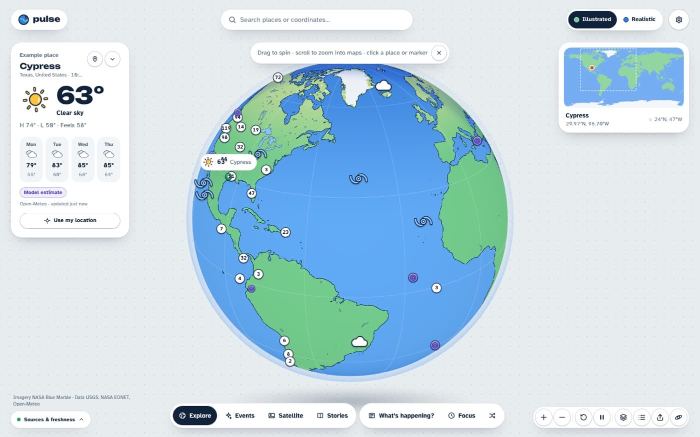
A 3D globe that shows live earthquakes, storms, fires, weather and satellite imagery.
- Role
- Solo project
- Category
- Data Visualization
- Status
- Complete
- Stack
- Next.js, React Three Fiber, MapLibre GL, NASA GIBS, USGS, Cloudflare Workers
(01) What it is
The project
You can spin a 3D Earth and zoom straight down into a detailed local map. The globe and the map share one camera, which is what keeps the switch between them smooth instead of jumpy.
It pulls live hazard data from NASA and USGS, weather from Open Meteo and dated satellite images from NASA GIBS. Every data point shows its source and when it was last updated.
(02) Details
How it works
- 01One shared camera model for the globe and the map
- 02Live earthquakes, storms, fires and volcanoes from NASA EONET and USGS
- 03Weather from Open Meteo and dated satellite imagery from NASA GIBS
- 04Built with React Three Fiber and MapLibre, deployed on Cloudflare Workers